
Dr Sue Hull, Senior Lecturer in Marine Biology and Ecology / Programme Director for Marine Biology, University of Hull
It feels like you are walking towards the end of the world heading south from Easington. Here, down at the estuary end of Humber Side Lane there is a curious mixture of the natural and the human-made, the future and the past all intermingled in the area between land and sea. These muds and silts of the Humber with the water glistening in the sun at least 500m away at low tide provide habitat for a wealth in of intertidal invertebrates. From worms to clams, they occur as patches of free food for thousands of over-wintering wading birds and the salt marsh itself provides them cover from the brisk winds at high tide. Here in the intertidal, one of the harshest marine environments there is, marine species are exposed to terrestrial and fully marine conditions at the whim of the tide. Here we become aware of a bleak, uniform, and unforgiving landscape.
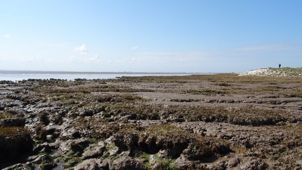
View from bottom of Humber Side Lane looking west towards the city
Looking west, Hull appears as a mirage in the distance – a centre of commerce, with developing industries on the shoreline investing in new technologies such as alternative energy generation. The new factories producing wind turbines are essential to help secure the energy needs of the future, and are set in the apparently timeless landscape of the marshes and muds. As you walk along the human-made banks, engineered against rising sea levels, the area might appear unchanging and uniform. This disguises the dynamic and shifting nature of the muds and the abundant estuarine invertebrate life hidden below the surface.
It is the marsh plants, the cord grasses, sea purslane etc. that create structure in the amorphous muds; nature excelling as an engineer creating banks and runnels, with deep roots binding the muds together and creating at patchwork quilt of vegetated areas, mud and pools, all teeming with invisible life below the surface. But these plants do more – you only see 1/3 of their biomass above the mud surface, below the muds they trap carbon out of the atmosphere in their roots aiding the fight against climate change alongside the new technologies made in the city.
And yet, all is not as simple as it seems. Looking east, emerging from the muds in the intertidal there are large concrete structures that remain somewhat enigmatic as there is no information about them. These relatively modern megaliths were not placed as places of worship, but probably as sentinels against invaders or as false port structures to fool bombers during WW2. A reminder of less peaceful and unsettled times last century; and yet the invaders still come – in this case, small numbers of Australian barnacles (Austrominius modestus) accidentally introduced into UK waters by returning warships after WW2, an invasive marine species spreading around the UK to claim new territory. People always say Australians are tough, and these small crustaceans are exactly that, tolerating conditions other marine species cannot.
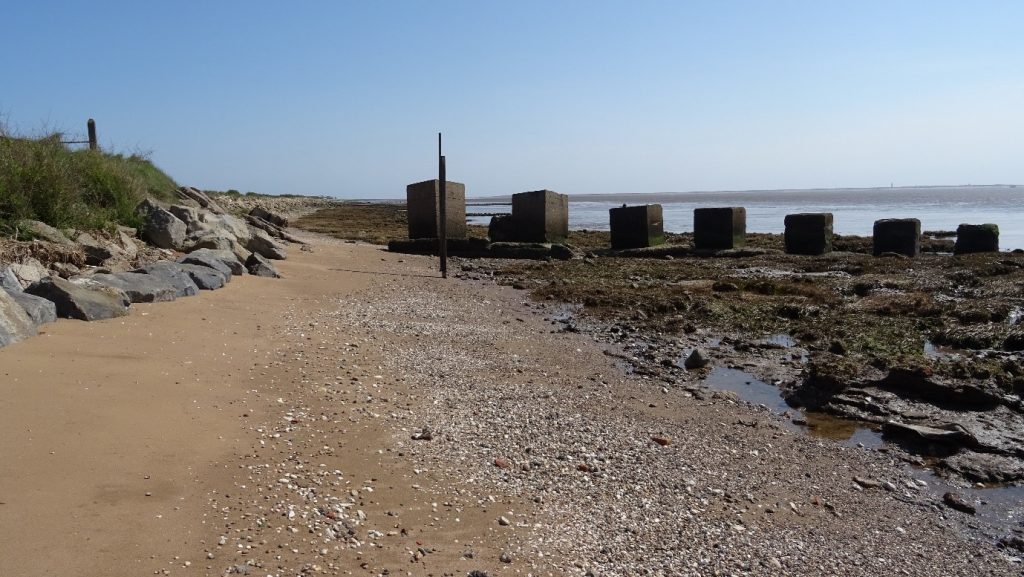
Looking towards Spurn with concrete defensive structures in the foreground
Alongside these, native species more typical of our rocky coasts such as Bladderwrack and Spiral Wrack occur on the surface of the concrete and an incursion of shore crabs and winkles are found amongst the rocks. However, these are far more abundant on the rocky shores of Flamborough but are examples of the few marine species toughing it out here in the more changeable and less saline estuarine conditions.
From here to Spurn, hard human-made structures such as coastal defences, drains, old pier supports are colonised by native rocky shore species where they are in reach of the tide. Only the toughest survive here due to the ever-changing salinity of the water. Heading east, the marshes become dominant again, and we can start to see the curve of Spurn point, the narrow spit of sand that acts as the last defence from the North Sea alongside the sea forts placed at the mouth of the estuary. The vast expanse of featureless intertidal muds and marshes are more important that we first realise. They trap atmospheric carbon, act as a food supply for over-wintering and migrating birds, support a commercial fishery and internationally important nature reserves and provides soft coastal defences to the precious farmland on the landward side. The intertidal area is a hidden world with a far larger role to play in protecting our future than would seem at first glance.
As we place more coastal defences around our coasts to protect our assets, we can take steps to make these more amenable for wildlife. We can use engineering solutions to create new habitat for species threatened by rising sea levels and habitat change. Such ecological enhancement is part of the research conducted at the University of Hull, and the author of this article would be happy to tell you more about this. Please contact Dr Sue Hull for further information.